Part Four
Your Watershed
Inquiry Questions
|
|
STEP ONE
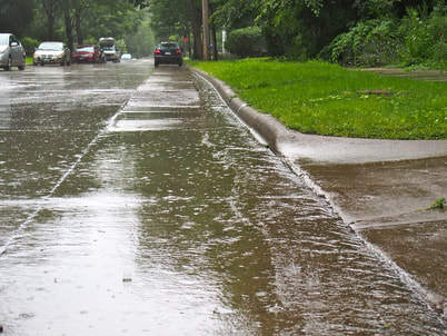
Let’s investigate your own watershed. Think about a rainstorm in your neighborhood. Where does the water flow as it collects in the gutters? Once it goes past your residence, where does it go? Draw a model of your home and where the water flows. Include:
- arrows to indicate the direction of water flow,
- mark the storm drain where the water flowing by disappears
- a compass rose
- labels for your house and street
Usually water from a storm (especially in a town or city) will flow into a storm drain and then move through a collection of pipes to the nearest river or creek. What creek is near your home? On your model, draw the creek where you think the stormwater flowing past your house eventually ends up. Make a dotted line to show the route water flowing past your house may take as it flows to this creek. Remember parts of this route may be underground. Here is an example:
|
|
STEP TWONow we will look at some data that may help you adjust your model. Watch this short video that will help you navigate the website we will be using.
After watching the video, go to the online map at https://cocorahs.erams.com/ . Follow the instructions below:
Go back to your model and make any adjustments with the information you have learned from the online map. |
SYNTHESIZE
On a separate sheet of paper or other format requested by your teacher answer the following questions:
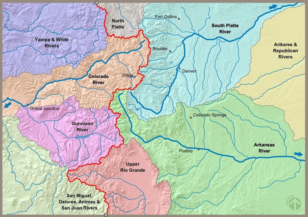
- What is the name of your watershed? What is the name of the basin where your watershed is located?
- Name the state(s) that are part of the basin where you watershed is located.
- Is this on the east or west side of the Continental Divide? Using what you know about 80% of the precipitation falling on the west side of the Continental Divide, how will this impact water flow and water use in your watershed?